Lots of misinformation in here, the majority of which I don't care to address but I'll just quickly say this: keep in mind that provisions and ROW for the ultimate plan doesn't mean the ultimate plan will be built in its entirety. Also keep in my mind that almost every major thoroughfare in Calgary is underbuilt to handle to volume of traffic they currently serve, so when you see plans for interchanges that are correctly sized for the anticipated volume, they appear unnecessarily large.
The Following User Says Thank You to Acey For This Useful Post:
The ultimate plan would be massive, but Calgary's population is also forecasted to increase by over 100,000 people in the time this portion of the road is being constructed. I'm not equating that to 100,000 more cars on the SW portion of the ring road, but as others in this thread have said, I wish the original Deerfoot planning demonstrated some sort of eye towards future growth.
Really this thread makes me curious about what planning originally went into Deerfoot and if they had an ultimate plan before someone said "nah, #### it.. let's just throw down some lanes and see where they go".
Really this thread makes me curious about what planning originally went into Deerfoot and if they had an ultimate plan before someone said "nah, #### it.. let's just throw down some lanes and see where they go".
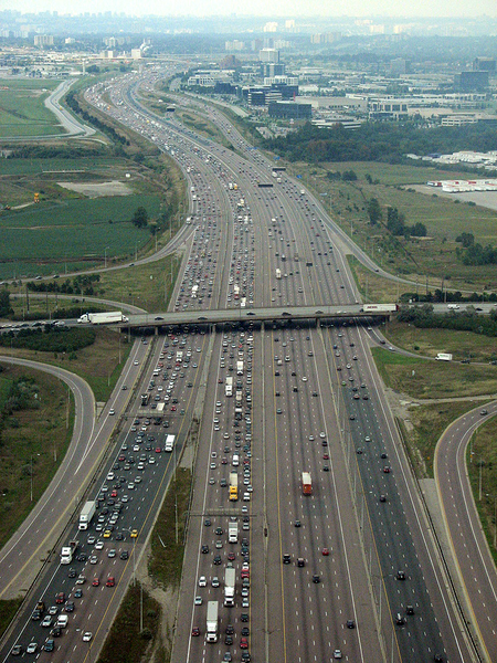
The first segment (north city limits to 16th Ave) opened in 1971, when Calgary's population was just over 350,000.
Originally, the next segment would have crossed the river east of the zoo and would have cut through the middle of Inglewood. It would have essentially run straight south from Memorial to where it currently turns south after the Calf Robe Bridge. That alignment would have pretty much wiped Inglewood off the map, but we wouldn't have had all the problems of the Calf Robe and that stretch of Deerfoot. Inglewood residents successfully protested against the original alignment, and we got what we have now.
The southern portion of the Deerfoot originally was to go south of Anderson (likely following the same route that Bow Bottom Trail currently follows) through Fish Creek Park. Presumably, this portion would have connected to 22X around where Lake Sikome is. Peter Lougheed blocked this alignment from happening because he didn't want a freeway cutting through his newly-established Provincial Park.
Deerfoot Trail and the City of Calgary would both look a lot different today if they had built to the original plans.
__________________
Turn up the good, turn down the suck!
The Following 3 Users Say Thank You to getbak For This Useful Post:
Are they doing 162nd? I haven't seen that despite my thinking it is absolutely necessary.
I drove past the intersection of Macleod & 162nd a couple weeks ago and recall seeing a sign about future interchange improvements.
Are they actually going to do something about the intersection at Macleod & 162nd (finally)? From what Ive read its one of the worst in the city for congestion during rush hour, but falls outside of the scope of the ring road project (ring road is provincial while Macleod & 162nd St is municipal)
Yes - project is funded and design and engineering is underway. There's an open house this weekend at Bishop O'Byrne High School.
I do not drive into the area west of Macleod and 162 often (once every few years) but this August I did and the traffic back-up on 162 due to the lights and lrt is ludicrous for amount of time it takes to get through.
Really can't believe city designers think those types of traffic back-ups as daily routine would be acceptable. As a visitor that day I was fed up... I do not know how all who live in area handle that daily at peak times. Hope city looks at some way of building overpass but probably not I do not think room for that in area as currently developed.
The Following User Says Thank You to Inferno099 For This Useful Post:
Does anyone know (Acey?) why the SB lanes between McKnight and 16th are so far away from the NB lanes? Google maps doesn't really do it justice, but IRL, the two directions are unusually far apart. I can't figure out what purpose this serves, other than to take up way more space than necessary.
Suspiciously, it happens right where a possible connector to 32 ave would be, but none of the other interchanges have lanes that far apart. I must know the reason for this. It keeps me awake at night.
I was curious about the plans for Macleod & 162nd St so I attended the open house held earlier today. There are about 7 interchange options available (mainly partial cloverleaf and diamond). They all seem fairly reasonable and the most important part is that all of them involve getting rid of the lights at Macleod & 162nd St. 162nd St will go over Macleod and have lights but Macleod will be free flowing for traffic
The Following 2 Users Say Thank You to Calgary14 For This Useful Post:
Does anyone know (Acey?) why the SB lanes between McKnight and 16th are so far away from the NB lanes? Google maps doesn't really do it justice, but IRL, the two directions are unusually far apart. I can't figure out what purpose this serves, other than to take up way more space than necessary.
Sour gas wells/piplines (and possibly other utilities) got in the way for the NE leg. I don't know much beyond that.
The Following User Says Thank You to Acey For This Useful Post:
It's possible. Prentice has said though he will use debt to fund infrastructure, to what extent that's the question. He will have a $7billion shortfall next year at current oil prices. This will be tough.